Cay Hopping to Georgetown


Alan hunting a big grouper

We left Staniel Cay with the intention to get to Georgetown pretty quickly, but in short hops. We pulled into a different anchorage each night, and left early in the mornings.

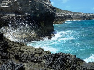
First we stopped at Little Farmers Cay. Our timing was off for the tides, so it was a really sporty ride getting through the cut, but we made it without incident. This is the first place we’ve been where our Navionics charts have been WAY off. They showed 1-3 feet of water in a large area where we found nothing less than eight feet. Fortunately, by now we felt pretty confident in our ability to read the water, so we proceeded with caution, and were fine. Our ancient Explorer Charts showed more depth, and were ultimately more accurate, and that also gave us confidence. We had a nice evening there visiting with the crew of s/v Monarch, who pulled in right after us from the other side. We took off as soon as we had decent light in the morning. Leaving, we also sailed right over water marked on the chart as 3.5 – 4 feet, but had plenty of depth: 8 feet or more again. We re-entered the Atlantic side of the water through Galliot Cay Cut, and were stunned at the beauty of that area. We hated to pass it by, and I’m sure we’ll return someday. Read more

Warderick Wells – Exumas Land and Sea Park

Cliffs at Warderick Wells

Warderick Wells

We left Shroud Cay on a forecast of 12-17 knots of favorable wind and 3-5 foot seas. Let me tell you what I’ve learned about forecasts: they are sometimes made up. They are made up to encourage boaters to get out and sail, I guess. Often, they have little to do with reality. This was one of those times. The wind direction was less favorable than predicted, which was ok but meant that, in order to sail, we had to go a little wide of our destination. OK, we do this all the time. No big deal. The wind was also 20-25 knots as the day went on, gusting 30ish. Well, that’s a good bit of wind, but we have had 30 knot gusts before. Not ideal, but doable. Our boat can handle that, and so can we. The real issue was the sea state. 3-5 feet? Try 6-8. Gross. Uncomfortable. Hard on the boat, hard on the crew. And it caused us to make ridiculously slow progress. We had planned to get into Warderick Wells at slack tide, but instead we got to come in against the running tide to take a mooring in the narrow river of water at this park. We made it fine, but my nerves were shot by the time we did. Read more

Shroud Cay – Exumas Land and Sea Park

A snorkel selfie at Shroud Cay

Exploring Shroud Cay, Exumas

From Rock Sound, Eleuthera, we took off towards the Exumas. This long, narrow chain of islands is known for pristine waters for snorkeling – one of my favorite things! So, although we were sad to leave the lovely people of Eleuthera, we got underway.

The trip across took about 8 hours, and we had to make it through a narrow cut to get to our anchorage once we made the Exumas. This meant we would need to time our arrival to coincide with the rising tide, so that we wouldn’t be fighting the rush of what can seem like a whole ocean flowing through a narrow creek. This time, the elements were cooperative, and though the trip was a bit more lumpy than either of us prefer, we were able to maintain speed and time it just right. Neither of us had much experience with piloting the boat in strong currents so close to reefs and rocks, so it was nerve-wracking, but ultimately just fine. We anchored on the West side of Highborne Cay, dove the anchor, swam around a bit, and had dinner and a good sleep. Read more